Greenbrier River Trail, WVA
- Nomadic Grandma

- Dec 22, 2022
- 4 min read
My timing on this one was NOT good! In fact, I arrived in Cass, VA ready to start on the 78 mile Greenbrier River Trail along with torrential rain and some of the heaviest flooding in history. Rather than risk floating away in a river front campsite, I elected to stay in a hotel in Snowshoe. The hotel was beautiful and highly recommended, however given that Snowshoe is a ski resort and I arrived in mid-May, I was just about the only one there. In fact, mine was the only car in the hotel garage!
Grateful for a good night sleep, I headed to the trailhead in Cass first thing in the morning to meet up with a friend. Finding and parking in the large gravel lot was no problem, especially since, once again, no one was there. (And yes, there are porta-potties available.) Because of the storm, and perhaps a bit of bad luck, our starting temperature was a mere 38 degrees and both the trail and parking lot were muddy in places.

Although Cass has the reputation for being a quaint little rail town, honestly I found it rather depressing. I also found this end of the trail... well... a little creepy. Perhaps it had more to do with the weather than anything else, but navigating this section was difficult. The area of the trail around Cass is extremely remote - there is no cell service and on two different occasions, I found myself riding towards men seemingly just standing about. Honestly, had I not had a male friend riding with me, I most definitely would have turned around. I'm sure the rain, fog, mud, cold temps and random trees cracking around me added to my overall anxiety, but even without those factors, this is a very remote, isolated trail with no cell service for miles. As a single woman who typically rides alone, this section wouldn't be first on my list. It does parallel the Greenbrier river, which is beautiful, but since most of the trail also does this, that fact alone wasn't much compensation.
Anyway, as luck would have it, our time on this section was cut short by a pretty massive barricade of freshly fallen trees. Far too cumbersome to haul the bikes over, (yes, we tried), and hemmed in by the river and a mountain, we had no choice but to backtrack the 13 miles or so we had traveled.

Cold, frustrated, and once again standing in the trailhead parking lot Cass, the logical plan seemed to be to return to Snowshoe for the night. Nothing a hot shower, glass of wine and spaghetti dinner can't fix. (And clearly finding a hotel with availability wasn't going to be a problem - the second car here is my friends.)

In the morning we made the drive to Marlinton WVA and set off again to ride the section of the trail from Watoga State park back to where the tree had fallen outside of Cass. The sun was shining and both the temperature, and my mood, quickly improved.
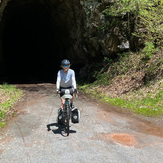
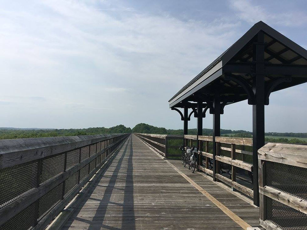
Although there are a total of 35 bridges and two tunnels on the Greenbrier River trail, the Watoga bridge and Sharps bridge / tunnel are perhaps the most noteworthy. Marlinton is also a more populated town with several opportunities for lunch, etc. Though cell service remains limited or non-existent along this section, I think psychologically knowing that the town of Marlington was within reach, helped me feel safer / less isolated.
In short, this proved to be a great day and a gorgeous ride. There are well-maintained porta-potties and numerous first-come / first-serve campsites scattered about. Picnic tables are also abundant along the trail. (We had a picnic lunch in Clover Lick.)
Perhaps the most frustrating part of planning for the Greenbrier River Trail is the absence of maps with mile markers. My friend, Steve compiled this milage chart for our trip and I'm hoping he won't mind me sharing it here. (Thanks Steve!) It also includes water, restrooms and parking locations.
Before you go:
If you're planning to ride the Greenbrier please remember: There is no cell service along most of this trail. That's pretty well advertised, but I'm guessing most people don't understand that there are also no support services available for long stretches of the trail. Unless you're traveling in a group or are skilled at bike repairs, carry a pump, spare tube, patch kit, etc. help could easily be hours away, (especially during the week or in bad weather - we saw very few other riders on a Friday in May.)
Also based on my experience, road blocks can and do occur. In some places the trail is literally sandwiched between the river and mountain, there is simply no way around an impassable section of trail, so plan accordingly. (I'm so grateful we had only 13 miles to retrace back to the car rather than our planned daily total of 45). Though the trail appears to be extremely well maintained, tree removal, etc. can take awhile.
Though freezing weather kept the bugs at bay during my visit, I'd imagine they can be quite an issue during warmer months. (lots of tree cover and standing water). Plan accordingly - especially if you intend to camp. And finally be sure to bring lights for the tunnels - particularly Sharps tunnel! (Even with a light, it took me a minute to be brave enough to enter such a wet dark seemingly endless curving tunnel. (It's fine once you adjust to the idea, but that first 25 feet took a little getting used to.)


Comments